CDT Permit DetailsFour Required Permits, For One Epic Journey
Planning & Preparation
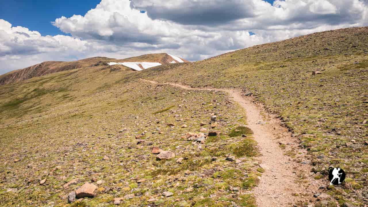
Complete Continental Divide Trail guide covering all five sections from Mexico to Canada. Learn what to expect, resupply towns, and terrain across 3,000 miles of America’s wildest trail.
Quick Trail Facts
Difficulty: Hard
Distance: 3100 mi
Elevation Gain: 460,000 ft
Crazy Cook Monument, New Mexico – Glacier National Park
Average Time: 5-7 Months
Permit Required?: true
The Continental Divide Trail spans approximately 3,100 miles (4,989 km) through five states along the spine of the Rocky Mountains, with a total elevation gain of roughly 440,000-460,000 feet. With the highest point reaching 14,278 feet at Grays Peak in Colorado, this most rugged of the Triple Crown trails demands superior navigation skills, physical endurance and mental resilience.
You can hike this trail northbound (NoBo) or southbound (SoBo). This guide follows the trail northbound from south to north, but choose whichever direction suits your schedule and snow conditions.
The journey begins at the Crazy Cook Monument on the New Mexico-Mexico border in the desolate Chihuahuan Desert. This remote terminus requires careful planning: there are no services here. The landscape opens with sparse creosote bush flats, volcanic peaks and notoriously challenging water sources. Expect cattle tanks and alkaline springs that require treatment and filtering. The desert sun is unrelenting in late spring and summer.
Nearby Towns:
Moving north through New Mexico, you’ll traverse the longest state section on the CDT. The Gila River Alternate is highly recommended: it cuts 75 miles while adding reliable water through stunning canyon scenery with 200+ river crossings. This region features the Gila Wilderness, volcanic badlands of El Malpais and eventually climbs onto the Colorado Plateau with ponderosa forests. Water remains the primary challenge, with stretches of 20-40 miles between sources common.
Nearby Towns:
Navigation Note: New Mexico requires the most route-finding, as the trail is only about 70% complete with multiple official alternates and road walks.
Colorado delivers the CDT’s most spectacular and punishing terrain. You’ll spend the majority of these miles above 10,000 feet, often crossing timberline at 11,000-12,000 feet. The trail coincides with much of the Colorado Trail through the San Juan Mountains, Collegiate Peaks and Rocky Mountain National Park. Grays Peak summit offers the highest point on the entire CDT at 14,278 feet. Late-season snow in the San Juans often forces hikers to take the Creede Cutoff alternate to avoid dangerous conditions.
Nearby Towns:
Challenge: Colorado was voted the most difficult state by 81% of thru-hikers. Plan for slower mileage than anticipated.
Wyoming offers stark contrasts. The trail begins in the Great Divide Basin: a 120-mile stretch of waterless high desert where the Continental Divide splits, forming an enormous bowl. Many hikers night-hike through the Basin to avoid scorching daytime heat. Water is scarce and unreliable. After escaping the Basin, you’ll climb into the magnificent Wind River Range with its jagged granite peaks, wildflower meadows and the largest concentration of glaciers in the Lower 48. The section culminates in Yellowstone National Park with geothermal features, wildlife and tourist crowds.
Nearby Towns:
Wildlife Alert: This is prime grizzly bear country: proper food storage and bear spray are essential.
The shortest state section features rolling terrain along the Idaho-Montana border. The trail traverses the Centennial Mountains with exposed ridgelines and expansive views before dropping into forested valleys. You’ll cross Lemhi Pass, the highest point Lewis and Clark’s expedition traversed. This section offers a breather after Wyoming’s intensity, with generally easier terrain and more reliable water.
Nearby Towns:
Montana saves the best for last. After leaving the Idaho border, the trail enters the Anaconda-Pintler Wilderness with its alpine lakes and difficult terrain. Many hikers take the Anaconda Cutoff to access the town of Anaconda for resupply. The route continues through historic mining country before entering the Bob Marshall Wilderness Complex: one of the largest wilderness areas in the Lower 48. Here you’ll experience the spectacular Chinese Wall, a 12-mile limestone escarpment. The grand finale unfolds in Glacier National Park with dramatic peaks, remaining glaciers and the northern terminus at Waterton Lake: the lowest point on the trail at 4,215 feet.
Nearby Towns:
Border Crossing: The trail ends at the US-Canada border. NoBo hikers must call Canadian customs upon arrival. Carry your passport.
Permits & Regulations
Unlike the PCT, the CDT has no single thru-hiker permit. However, overnight permits are required for Yellowstone National Park, Glacier National Park and Rocky Mountain National Park. These can typically be obtained as walk-up permits, though flexibility with camping locations helps. Glacier and Yellowstone permits can be challenging during peak season.
When to Hike
Northbound hikers typically start April to early May to reach Colorado in June when snow begins melting in the high country. Southbound hikers start June to early July to avoid Glacier’s snow. The season generally runs through October, with snow being the primary determining factor for both start and end dates.
Navigation Skills Required
The CDT is approximately 70% complete with numerous alternates, road walks and unsigned sections. You’ll need strong map and compass skills, GPS device or app (FarOut is essential) and the ability to route-find in areas where trail tread disappears. This is not a trail you can casually follow white blazes.
Water & Wildlife
Water sources in New Mexico and the Great Divide Basin are scarce and often questionable quality: carry treatment and capacity for 20-40 mile dry stretches. Montana and northern sections require bear spray and proper food storage in grizzly country. Also expect encounters with rattlesnakes in southern sections, moose, elk and mountain goats in high country.
Resupply Strategy
Most thru-hikers use a combination of buying in town and mailing boxes (roughly 50/50 split). In New Mexico and Idaho/Montana border towns, mailing boxes ahead is often necessary due to limited store options. Colorado towns generally have good grocery stores. Hitchhiking is common and necessary: many towns sit 10-30 miles off trail. Some hitches (Chama, Dubois, Lake City) can be challenging.
Essential Gear
Don’t underestimate this trail. Cold-weather gear for Colorado’s high elevations, ice ax and microspikes for snow travel (can mail ahead to skip carrying entire time), bear spray for Montana, water capacity for desert sections and a reliable navigation system are all critical. Many hikers also carry a personal locator beacon (PLB) due to the remote nature of sections
Planning & Preparation