
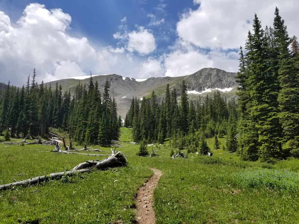
This itinerary is designed for beginner hikers tackling the 486-mile Colorado Trail southbound from Denver to Durango. The plan assumes you’re starting without trail legs, beginning with conservative 10-mile days and gradually building up your daily mileage as you get stronger. The schedule includes 5 resupply stops (roughly one per week) with opportunities for NERO (Nearly Zero) or ZERO days in towns.
Total Trail Days: 30 hiking days
Total Zero Days: 5 days (one in each town)
Overall Duration: 35 days
Average Daily Mileage: ~16 miles (starting at 10, building to 18-20)
Total Elevation Gain: ~89,000 feet
Week 1: Getting Your Trail Legs (Days 1-7)
Segment 1-3 | Waterton Canyon to Top of Little Scraggy Peak
Day 1: Waterton Canyon Trailhead to Mile 10
- Distance: 10 miles
- Elevation Gain: +1,600 ft | Loss: -200 ft
- Highlights: Bighorn sheep in Waterton Canyon, Strontia Springs Dam
- Water: Plentiful along South Platte River
- Camp: Dispersed camping near trail
Day 2: Mile 10 to South Platte River Crossing (Mile 20)
- Distance: 10 miles
- Elevation Gain: +1,400 ft | Loss: -600 ft
- Highlights: Gudy Gaskill Bridge, enter Pike National Forest
- Water: Multiple creek crossings
- Notes: First real climbing begins
Day 3: Mile 20 to Mile 30 (Near Rolling Creek)
- Distance: 10 miles
- Elevation Gain: +2,200 ft | Loss: -800 ft
- Highlights: Lost Creek Wilderness boundary
- Water: Rolling Creek, seasonal streams
- Notes: Terrain gets rockier
Day 4: Mile 30 to Mile 42 (Lost Creek Wilderness)
- Distance: 12 miles
- Elevation Gain: +2,000 ft | Loss: -1,500 ft
- Highlights: Long Gulch meadows, wildflowers, wildlife
- Water: Good sources throughout
- Notes: Building up mileage gradually
Day 5: Mile 42 to Mile 54 (Near Rock Creek)
- Distance: 12 miles
- Elevation Gain: +1,800 ft | Loss: -2,100 ft
- Highlights: Aspen groves, alpine meadows
- Water: Rock Creek, multiple tributaries
Day 6: Mile 54 to Kenosha Pass (Mile 64)
- Distance: 10 miles
- Elevation Gain: +1,600 ft | Loss: -900 ft
- Highlights: Approach to Kenosha Pass
- Notes: Prepare for first resupply tomorrow
Day 7: Kenosha Pass to JEFFERSON – RESUPPLY DAY / ZERO
- Distance: Hitch 4.5 miles to Jefferson
- Town Access: US Highway 285 crosses trail at Kenosha Pass – easy hitch
- Services: Small grocery store, restaurants, post office
- Lodging: Limited; consider staying in nearby Bailey (8 miles) for more options
- Notes: Take a full zero day to rest, do laundry, resupply for next 100 miles
Week 2: Entering the High Country (Days 8-14)
Segment 6-8 | Kenosha Pass to Tennessee Pass
Day 8: Jefferson back to Kenosha Pass, hike to Mile 76
- Distance: 12 miles hiking
- Elevation Gain: +1,900 ft | Loss: -1,200 ft
- Highlights: Georgia Pass approach, CDT junction begins (Segment 6)
- Water: Multiple sources
- Notes: Feeling refreshed after zero day
Day 9: Mile 76 to Mile 90 (Near Gold Hill)
- Distance: 14 miles
- Elevation Gain: +2,400 ft | Loss: -1,800 ft
- Highlights: Gold Hill area, views expanding
- Water: Streams becoming more alpine
- Notes: Elevation now consistently above 10,000 ft
Day 10: Mile 90 to Gold Hill Trailhead (Mile 103) – Short day
- Distance: 13 miles
- Elevation Gain: +1,800 ft | Loss: -2,200 ft
- Highlights: Approaching Breckenridge area
- Water: Good sources
- Notes: Exit at Highway 9 tomorrow for resupply
Day 11: BRECKENRIDGE/FRISCO – RESUPPLY DAY / ZERO
- Town Access: Gold Hill Trailhead on Highway 9; FREE Summit Stage bus runs every 30 minutes between Frisco and Breckenridge
- Services: Full grocery stores (Safeway, Whole Foods, Walmart in Frisco), excellent outfitters, breweries, restaurants
- Lodging: Many options (book ahead on weekends)
- Notes: This is a major resupply point. Stock up well for the 75-mile stretch to Twin Lakes
Day 12: Back to trail, hike to Mile 115
- Distance: 12 miles
- Elevation Gain: +2,600 ft | Loss: -1,400 ft
- Highlights: Approaching Copper Mountain
- Water: Multiple sources
Day 13: Mile 115 to Mile 128 (Copper Mountain Area)
- Distance: 13 miles
- Elevation Gain: +2,200 ft | Loss: -1,800 ft
- Highlights: Copper Mountain Resort visible, Kokomo Pass
- Water: Regular streams
- Notes: Trail crosses below ski runs
Day 14: Mile 128 to Mile 143 (Searle Pass approach)
- Distance: 15 miles
- Elevation Gain: +3,200 ft | Loss: -2,000 ft
- Highlights: Tennessee Pass approach, high alpine terrain
- Water: Cataract Creek, seasonal sources
- Notes: Building endurance – this is your longest day yet
Week 3: The Collegiate Peaks (Days 15-21)
Segment 9-12 | Tennessee Pass to Highway 50
Day 15: Mile 143 to Mile 158 (Holy Cross Wilderness)
- Distance: 15 miles
- Elevation Gain: +2,800 ft | Loss: -2,400 ft
- Highlights: Mount Massive Wilderness, stunning peaks
- Water: Multiple alpine streams
- Notes: Incredible scenery begins
Day 16: Mile 158 to Mile 174 (Near Halfmoon Creek)
- Distance: 16 miles
- Elevation Gain: +2,400 ft | Loss: -2,800 ft
- Highlights: Mount Elbert area (14,440 ft – Colorado’s highest peak)
- Water: Good sources
- Options: Possible side trail to summit Mt. Elbert (add 9 miles round trip)
Day 17: Mile 174 to Twin Lakes/Highway 82 (Mile 183) – NERO
- Distance: 9 miles
- Elevation Gain: +1,200 ft | Loss: -2,400 ft
- Highlights: Descent to Twin Lakes Village
- Town Access: 1.5 miles walk on road from trail to Twin Lakes
- Services: General Store/Post Office (limited resupply), restaurant
- Lodging: Twin Lakes Inn
- Notes: NERO day – short mileage, afternoon rest in town, possible resupply pickup if you mailed a box. Not a full zero.
Day 18: Twin Lakes to Mile 200 – Decision Point
- Distance: 17 miles (from town back to trail and hiking)
- Elevation Gain: +3,800 ft | Loss: -1,600 ft
- Highlights: DECISION POINT – Choose Collegiate East or Collegiate West
- Notes:
- Collegiate East: 78.1 miles, lower elevation (9,000-10,000 ft avg), easier town access to Buena Vista
- Collegiate West: 83.2 miles, higher elevation (11,000-13,000 ft avg), more scenic, more remote
- This itinerary follows Collegiate East for better resupply access
Day 19: Mile 200 to Mile 218 (Collegiate East Route)
- Distance: 18 miles
- Elevation Gain: +2,600 ft | Loss: -2,200 ft
- Highlights: Pine Creek, approaching Mount Yale
- Water: Good sources
- Notes: Your fitness is improving – 18 miles feels manageable now
Day 20: Mile 218 to Mile 235 (Near Clear Creek Road)
- Distance: 17 miles
- Elevation Gain: +2,400 ft | Loss: -2,800 ft
- Highlights: Collegiate Peaks views
- Notes: Prepare for Buena Vista resupply tomorrow
Day 21: Mile 235 to Buena Vista – RESUPPLY / ZERO
- Distance: Short morning hike to trailhead, 7-mile hitch to Buena Vista
- Town Access: Exit at Silver Creek Trailhead (FR-365), hitch to Buena Vista
- Services: Full grocery stores (LaGree’s, City Market), restaurants, brewery
- Lodging: Multiple hotels/motels
- Notes: Full zero day – this is one of the best resupply towns on the CT
Week 4: Through the Collegiates to Creede (Days 22-28)
Segment 15-17 | Highway 50 to Spring Creek Pass
Day 22: Buena Vista back to trail, hike to Mile 255
- Distance: 13 miles hiking (plus hitch)
- Elevation Gain: +2,600 ft | Loss: -1,400 ft
- Highlights: Chalk Creek drainage
- Notes: Rested and resupplied
Day 23: Mile 255 to Segment 15 end at Highway 50 (Mile 267)
- Distance: 12 miles
- Elevation Gain: +1,800 ft | Loss: -2,600 ft
- Highlights: End of Collegiate East, finish descent
- Water: Regular sources
- Notes: You can also resupply at Salida from here (short hitch), but we’re continuing
Day 24: Mile 267 to Mile 285 (Cochetopa Hills)
- Distance: 18 miles
- Elevation Gain: +2,400 ft | Loss: -1,800 ft
- Highlights: Marshall Pass, entering cattle country
- Water: IMPORTANT: Water can be scarce in next section – tank up
- Notes: Terrain becomes more arid
Day 25: Mile 285 to Mile 303 (Cochetopa Valley)
- Distance: 18 miles
- Elevation Gain: +1,600 ft | Loss: -2,000 ft
- Highlights: Wide open valley views, cow country
- Water: Limited – carry extra capacity
- Notes: Hot and dusty section
Day 26: Mile 303 to Mile 320 (Cochetopa Creek)
- Distance: 17 miles
- Elevation Gain: +2,200 ft | Loss: -1,400 ft
- Highlights: Return to good water, San Juan Mountains approach
- Water: Cochetopa Creek watershed – abundant water returns
Day 27: Mile 320 to Eddiesville Trailhead (Mile 333)
- Distance: 13 miles
- Elevation Gain: +1,800 ft | Loss: -2,200 ft
- Highlights: Beautiful aspen groves
- Notes: Prepare for Creede resupply
Day 28: CREEDE – RESUPPLY DAY / ZERO
- Town Access: Multiple options:
- Option 1: 1.5-mile side trail + 8-mile hitch on dirt FS road (preferred by many hikers)
- Option 2: Continue to Spring Creek Pass (Highway 149) for 33-mile paved road hitch
- Services: Good grocery, outdoor shop (San Juan Sports), restaurants, historic mining town atmosphere
- Lodging: Several options including hostel-style accommodations
- Notes: Charming town, many hikers’ favorite stop. Take a full zero. Last resupply before Silverton.
Week 5: The San Juan Mountains (Days 29-35)
Segment 20-28 | Spring Creek Pass to Durango
Day 29: Creede back to trail, hike to Mile 355
- Distance: ~15 miles hiking (varies by access point)
- Elevation Gain: +3,400 ft | Loss: -1,600 ft
- Highlights: Climbing into San Juan Mountains, La Garita Wilderness
- Notes: Terrain becomes dramatically more rugged and beautiful
Day 30: Mile 355 to Mile 373 (Jarosa Mesa approach)
- Distance: 18 miles
- Elevation Gain: +3,600 ft | Loss: -2,200 ft
- Highlights: Climbing toward highest point of CT
- Water: Alpine sources
- Notes: Altitude gains significantly – pace yourself
Day 31: Mile 373 to Mile 390 (Coney Summit area)
- Distance: 17 miles
- Elevation Gain: +2,800 ft | Loss: -2,400 ft
- Highlights: HIGHEST POINT: 13,271 ft near Coney Summit!
- Water: Limited at high elevation – plan carefully
- Notes: Spectacular views, watch weather for afternoon storms
Day 32: Mile 390 to Mile 408 (Weminuche Wilderness)
- Distance: 18 miles
- Elevation Gain: +2,600 ft | Loss: -3,200 ft
- Highlights: Entering Weminuche Wilderness, Colorado’s largest wilderness area
- Water: Streams returning
- Notes: Remote and rugged section
Day 33: Mile 408 to Mile 426 (Molas Trail approach)
- Distance: 18 miles
- Elevation Gain: +2,800 ft | Loss: -2,600 ft
- Highlights: High alpine lakes, stunning San Juan peaks
- Water: Lakes and streams abundant
Day 34: Mile 426 to Silverton/Molas Pass (Mile 440) – NERO
- Distance: 14 miles
- Elevation Gain: +2,200 ft | Loss: -3,000 ft
- Town Access: Molas Pass on Highway 550 – hitch 5 miles to Silverton
- Services: Small town, good restaurants, outdoor shop, historic mining town
- Lodging: Silverton Hostel (popular with hikers), hotels
- Notes: NERO or ZERO depending on timing. You’re almost done!
Day 35: Silverton back to trail, hike to Junction Creek Trailhead – FINISH!
- Distance: 20 miles (can split over 2 days if preferred)
- Elevation Gain: +2,400 ft | Loss: -4,800 ft
- Highlights: Final descent, approaching Durango, YOU MADE IT!
- Water: Good sources
- Notes: Last push to Junction Creek Trailhead in Durango. Celebrate!
Resupply Strategy Summary
Resupply Stop 1: Jefferson (Day 7) – Mile 64
- Days on trail: 7 days
- Next resupply: 39 miles (4 days)
- What to carry: 4-5 days food to Breckenridge
Resupply Stop 2: Breckenridge/Frisco (Day 11) – Mile 103
- Days on trail: 4 days since last resupply
- Next resupply: 80 miles (6-7 days)
- What to carry: 7 days food to Twin Lakes
- Notes: This is your biggest food carry
Resupply Stop 3: Twin Lakes (Day 17) – Mile 183 [NERO/Partial]
- Days on trail: 6 days since last resupply
- Next resupply: 52 miles (4 days)
- What to carry: 4-5 days food to Buena Vista
- Notes: Limited resupply unless you mail a box
Resupply Stop 4: Buena Vista (Day 21) – Mile 235
- Days on trail: 4 days since last resupply
- Next resupply: 98 miles (7 days)
- What to carry: 7 days food to Creede
- Notes: Stock up well – second longest food carry
Resupply Stop 5: Creede (Day 28) – Mile 333
- Days on trail: 7 days since last resupply
- Next resupply: 107 miles to Silverton (6 days) or 153 miles to Durango (7 days)
- What to carry: 6-7 days food to Silverton or finish
- Notes: Many hikers stop in Silverton for a NERO with a meal, then push to finish
Important Notes for Beginners
Altitude Acclimatization
- The CT averages 10,347 ft elevation
- Start slow – altitude sickness is real
- Drink extra water, expect lower performance initially
- Consider arriving in Colorado 2-3 days early to acclimatize
Weather Considerations
- Afternoon thunderstorms are common July-August (around 1-5 PM)
- Start hiking early, get below treeline by early afternoon
- Lightning is the #1 weather danger – take it seriously
- Always carry rain gear and warm layers
Water Management
- Most sections have good water, but some are dry
- Carry 2-3 liter capacity minimum
- Cochetopa Valley (Days 24-25) has limited water
- Filter/purify all water sources
Permits & Regulations
- No permit needed for CT
- Wilderness area regulations apply
- No campfires in many areas due to fire danger
- Familiarize yourself with Leave No Trace principles
Fitness Progression
- This itinerary starts at 10 miles/day
- Builds to 15-18 miles/day by week 3
- Listen to your body – adjust as needed
- Zero days are crucial for recovery
Bear Safety
- Black bears present but rarely seen
- Bear canisters or Ursacks recommended
- Hang food where possible, or sleep with it in secure bags
- More problematic: marmots and rodents can chew through packs!
Gear Considerations
- Lightweight is key at altitude
- Trekking poles highly recommended
- Good sun protection (hat, sunscreen, sunglasses)
- Layers for temperature swings (30s at night, 70s+ during day)
Additional Resources
- Colorado Trail Foundation: coloradotrail.org (official guidebook and databook)
- FarOut: Community comments about water, camping
- PMags CT Guide: pmags.com/colorado-trail-end-to-end-guide-2
- Facebook: Join “Colorado Trail Class of 20XX” for current year
- Weather: Mountain-Forecast.com for high-altitude forecasts
Your Journey Awaits!
This itinerary balances ambitious mileage goals with realistic expectations for a beginner. Remember that every hiker’s experience is different – weather, fitness level, and personal preferences will shape your actual journey. Be flexible, stay safe, and embrace the adventure. The Colorado Trail is one of America’s most spectacular long-distance trails, and you’re about to experience 486 miles of Rocky Mountain magic!
Trail life lesson: The miles you plan on paper rarely match the miles you hike on trail – and that’s okay. Adapt, adjust, and enjoy every step of this incredible journey.