
Arizona Trail | Sky islands, scorching deserts, and the Grand Canyon
A section-by-section breakdown of the Arizona Trail’s 800 miles. Discover what makes each region unique, where to resupply, and how to plan your journey from Mexico to Utah through desert, mountains, and the Grand Canyon.
Quick Trail Facts
Difficulty: Hard
Distance: 800 mi
Elevation Gain: 100,000 ft
U.S.-Mexico border – Arizona-Utah border
Average Time: 6-8 Weeks
Permit Required?: true
The Arizona Trail (AZT) spans 800 miles (1,290 km) from Mexico to Utah, divided into 43 passages that traverse desert valleys, sky island mountains, and the Grand Canyon. Most hikers complete the trail in 6-8 weeks.
Southern Section (Passages 1-13)
Distance: 235 miles (378 km)
Terrain: Sky islands, Sonoran desert valleys, canyons, and mountains
What to Expect
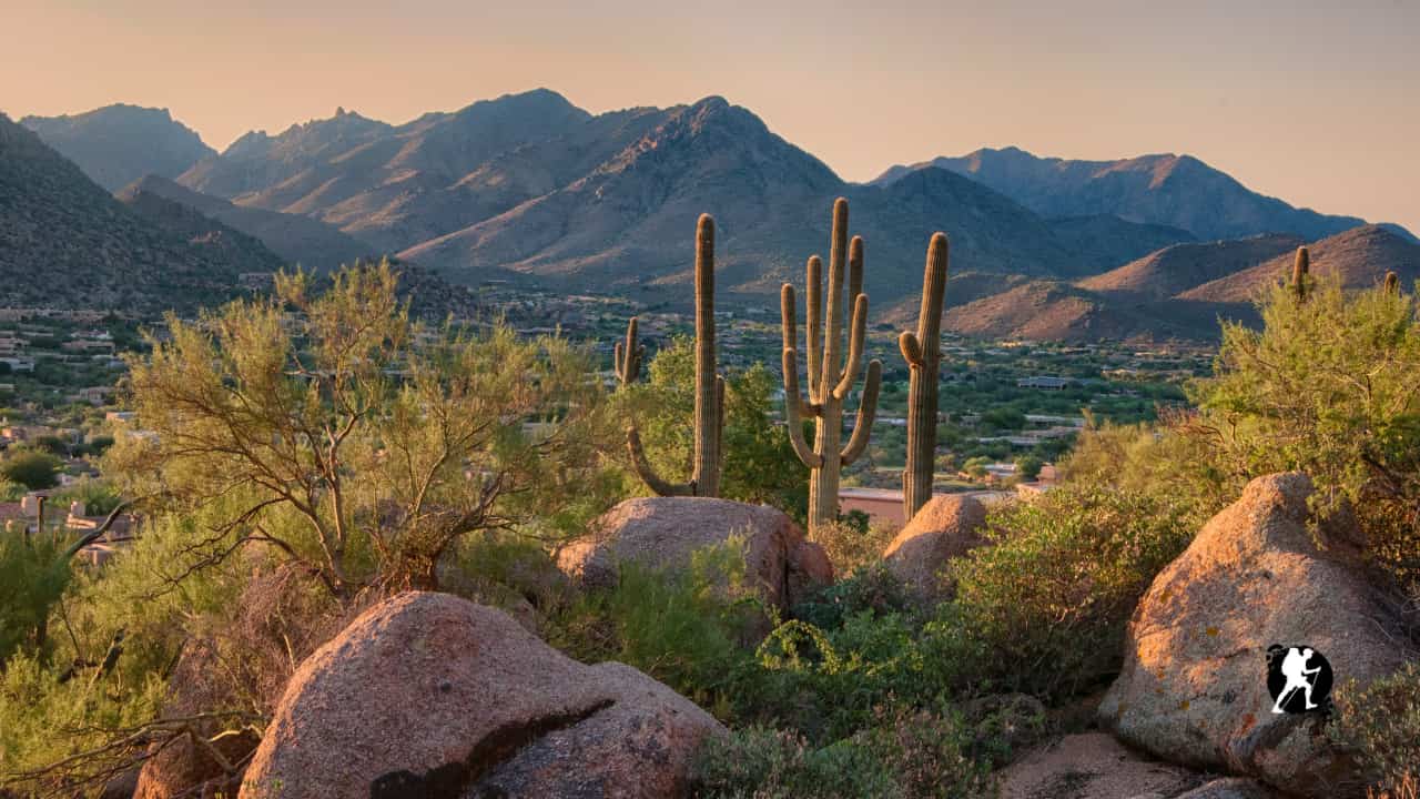
The southern section introduces you to Arizona’s “sky islands” – isolated mountain ranges rising dramatically from desert valleys. You’ll experience surprising diversity here, from saguaro forests to alpine meadows.
Key highlights: Saguaro National Park, Rincon Mountains, Santa Catalina Mountains, Oracle Ridge
Water availability: Moderate but variable; water caches are maintained by trail angels in drier stretches
Climate: Hot desert days, cool mountain nights; can experience snow in higher elevations (Oracle Ridge) even in spring
Town Resupply Options
- Patagonia (Mile 15): Small trail town near the southern terminus; full services including grocery, lodging, and restaurants
- Sierra Vista (Mile 40): Larger town with major resupply options; requires hitchhike or shuttle from Montezuma Pass
- Tucson (Mile 140): Major city with everything you need; easy access from multiple trail points including Colossal Cave
- Oracle (Mile 200): Small town with limited services; basic resupply and lodging
Central Section (Passages 14-26)
Distance: 270 miles (435 km)
Terrain: Sonoran Desert, mesas, canyons, volcanic features
What to Expect
This is the heart of the desert experience. Long, exposed passages with 40+ mile waterless stretches require careful planning and early morning starts. The Superstition Wilderness offers some of the trail’s most dramatic desert scenery.
Key highlights: Superstition Wilderness, Mazatzal Divide, Highline Trail, rugged desert canyons
Water availability: Scarce; multiple long dry stretches require carrying 6+ liters
Climate: Extremely hot during the day (especially April-May); pleasant mornings and evenings
Town Resupply Options
- Kearny (Mile 295): Small mining town; basic grocery and lodging
- Roosevelt Lake Marina (Mile 310): Limited resupply at marina store; lodging available
- Pine/Strawberry (Mile 395): Twin towns with groceries, lodging, and restaurants; popular resupply stop
Northern Section (Passages 27-43)
Distance: 291 miles (468 km)
Terrain: Ponderosa pine forests, volcanic plateaus, Grand Canyon, high desert
What to Expect
The northern section brings dramatic elevation changes and the trail’s crown jewel: the Grand Canyon. You’ll transition from ponderosa forests through the Canyon’s inner gorge and across the remote Kaibab Plateau to Utah.
Key highlights: San Francisco Peaks, Grand Canyon National Park (3 passages through the Canyon), Kaibab Plateau
Water availability: Generally better than central section; reliable springs in forested areas
Climate: Four-season conditions; snow possible on rim and plateau; extreme temperature swings in Grand Canyon (freezing nights, scorching days)
Town Resupply Options
- Flagstaff (Mile 455): Major city with complete services; popular zero day spot
- Tusayan (Mile 560): Gateway town to Grand Canyon South Rim; expensive but full services
- Grand Canyon South Rim (Mile 565): Park facilities including grocery, lodging, post office, and restaurants
- Jacob Lake (Mile 655): Small community with lodge, basic store, and restaurant; last resupply before Utah
Planning Notes
Permits Required:
- Saguaro National Park (free backcountry permit)
- Grand Canyon National Park (advance reservation highly recommended; competitive)
- Colossal Cave Mountain Park
Water Strategy: The AZT requires serious water planning. The AZT Water Report (maintained by trail angels) is essential – check it regularly and report conditions.
Best Direction: Most hikers go northbound (Mexico to Utah) starting late February to early March, timing warmer weather in the south with milder conditions in the north. Southbound hikers start in early October.
Navigation: Well-marked trail but GPS device or app (Guthook/FarOut) recommended for water sources and passage intersections.
Key Planning Notes to the Arizona Trail
Best hiking season:
- Northbound: Late February to early April start
- Southbound: Early to mid-October start
Permits:
- Required for overnight camping at: Saguaro National Park (passages 8-9), Colossal Cave Mountain Park (passage 8), and Grand Canyon National Park (passages 38-39)
- Grand Canyon permits are highly competitive; apply months in advance through recreation.gov or try walk-up permits at Backcountry Information Center (limited availability, April-June for thru-hikers)
- Optional but recommended: Arizona State Trust Land Recreation Permit ($15) if camping outside the 15-foot trail corridor on passages 6, 7, 14, and 15
Resupply strategy:
- Most hikers plan 8-12 resupply stops depending on food carry preferences
- The trail passes through or near approximately 20-30 towns, making it one of the most resupply-friendly long-distance trails
- Common strategies: Buy-as-you-go (easier, more flexible) or mail drops (better for dietary restrictions)
- Expect to carry 4-7 days of food between most towns; longest stretch is typically Pine to Grand Canyon South Rim (~115 miles, 6-8 days)
Water planning:
- Critical: Use the Arizona Trail Water Report (maintained by trail angels) – check regularly and report conditions
- Expect multiple waterless stretches of 20-40+ miles, especially in central section
- Plan to carry 6-10 liters on long dry stretches in hot weather
- Water caches maintained by trail angels but never rely on them as your only source
Navigation:
- Trail is generally well-marked but GPS device or app recommended (FarOut/Guthook)
- Essential for finding water sources, managing passages, and avoiding wrong turns
Physical difficulty:
- ~110,000 feet of elevation gain over 800 miles
- Rating: Moderate to Challenging due to water carries, heat exposure, long mileage days, and cumulative elevation